Hiking the Father Troy East Coast Trail : Flatrock to Logy Bay
Hiking the Father Troy East Coast Trail
Return to the ECT
This morning we woke up, refreshed and
thankful for the good weather forecast for today. Last night we
decided to spend our final two days in Newfoundland hiking some of
the East Coast Trail pathways north of St. John's. Initially, we planned to get a ride back up to Cape St. Francis and for two days push to see if we could complete our missing sections getting us back to St. John's. However, after contacting several taxi companies the cost of getting back up to Cape. St. Francis for the day (frequently noted by each company as being over $200.00 each way) led us to revise our plans. Instead, we opted to trek from Flatrock to St. John's with our remaining time.
We had breakfast and then took a taxi
up to Flatrock, where we began hiking south on Father Troy Path.
As we headed away from the parking lot at the trailhead everything
was obscured by dense fog. Luckily the trail was well marked, and we
had no trouble following it, even with the limited visibility back
over the harbour. As we walked we heard the distinct sound of a
whale spouting in the fog, and it seemed to be following along beside
us for quite some time.


For the most part, Father Troy's Path was easy walking – either on a wide flat track or on well-maintained and easy-to-walk footpaths. It followed along the coast, giving some beautiful views as the fog cleared and the sun came out.


We also passed a few of the fake batteries used to fool the German troops in WWII.

Somewhere in the vicinity of Church Cove, we passed a colony of nesting Black-legged Kittiwakes, which was noisy and busy and fun to watch.
The trail became quite confusing around Church Cove, and in the end, we stayed on the ECT (I think), without doing the Church Cove Loop. After this, the trail turned into a grassy track which followed along a beautiful wooden fence, through an old orchard and grassy meadow. Here the signs of civilization began to be more noticeable – we could see houses around us, hear traffic nearby, see airplanes flying overhead, and pass several people out walking their dogs.


Next, the trail took us over a grassy ridge and then down a staircase into a little harbour with a dock. There we signs at the top of the staircase warning hikers that the area was dangerous and prone to high tides and waves. Given the nature of the terrain on the other paths along the ECT, which did not receive any such warnings, these advisories seemed kind of strange, but I guess the closer one gets to civilization the higher the expectations of safety are.
We nodded hello to a couple fishermen
who we cleaning fish on the dock, and then took advantage of the
garbage can and porta-potty in the harbour. After that, it was a
climb, back up a staircase, and a short walk over a grassy ridge to
arrive at a subdivision and what we decided was the conclusion of the
Father Troy Trail (although we didn't find a sign).


Silver Mine Head Trail
At this point, our maps showed a short
community connector running along the coast to the beginning of the
Silver Mine Head Trail. However, when we started down it we soon
found the road and the trail were closed for construction. There was
actually a bulldozer at work and several workmen, so we ended up
having to walk up to Torbay Rd, along that to Marine Dr, and then
down Motion Drive, where we ended up taking a brief detour down
Motion Lane by accident. It seemed like a long, hilly road walk that
we didn't much enjoy, but if we had been thru-hiking, it is worth
noting that we did pass a Mary Brown's, a convenience store, and a
pharmacy in our travels. All in all, Torbay, the community we were
walking through, seemed to be a well-to-do suburb of St. John's –
busy, vibrant, and large.
When we finally arrived at the Silver
Mine Head trailhead we first headed down a grassy track behind some
large houses. Then we entered a section of “the unimproved” trail.
Although this didn't end up being too much more difficult than most
of the trails down south, it was very confusing due to a lack of
signs. We headed into a wooded area, and then came to Middle River,
a very active waterfall. There was a network of trails around the
river, but none seemed to go anywhere. As we were wondering what to
do, a kid passed us, crossed the river, and disappeared on the other
side. Oh.


Crossing Middle River was a bit difficult. The rocks were slanted and the water was high and fast-moving. However, we made it across safely, only to lose the trail again. We finally figured out that it went under a fallen tree, and emerged back on the coastline. After that point, the rest of the trail was pretty well maintained, with a nice wide pathway that offered great viewpoints and supported excellent infrastructure. We passed several other hikers out enjoying the day, including some kids.


At the end of the trail, we emerged onto Middle Cove Beach, which to our amazement was absolutely full of people. Upon closer inspection, we noticed that many of them were sporting nets and buckets, and we soon discovered that the 'caplin was rolling.' When this happens the caplin (a sardine-like fish) gather to mate near the beaches, and then, exhausted from spawning, they are tossed by the waves onto the beaches. People then gather on the beaches to collect them, either to enjoy as a tasty treat or to use as fertilizer in their gardens. There were so many families out on Middle Cove Beach that traffic was being directed by the police. Encountering these unexpected local events is what makes travelling fun!

After the beach, we started on a long, uphill, road walk. It was hot, the road was winding and very busy, and there were no shoulders, so it wasn't too pleasant. We did however pass a few viewpoints along Marine Dr that were full of people out enjoying the nice sunny weather. Finally, we turned onto Doran Dr, which was home to a whole row of mansions, complete with large lawns, metal fences, gated driveways, and numerous warnings that the properties were under 24-hour video surveillance. Although the view out over the harbour was gorgeous, we couldn't help but think back on Reg's and Kathy's simple 3-room cabin, with its postcard view over Fermeuse harbour, which was open to whomever walked passed, and wonder if the same degree of happiness they shared would even be possible behind all those walls.
Cobbler Path
At the end of the road, we came to the
trailhead for Cobbler Path. How to describe the Cobbler Path? I
loved this trail, it had everything - great views, wonderful
coastlines, forested tunnels, terrain that was easy enough to be
enjoyable, great trail infrastructure with intact boardwalks – what
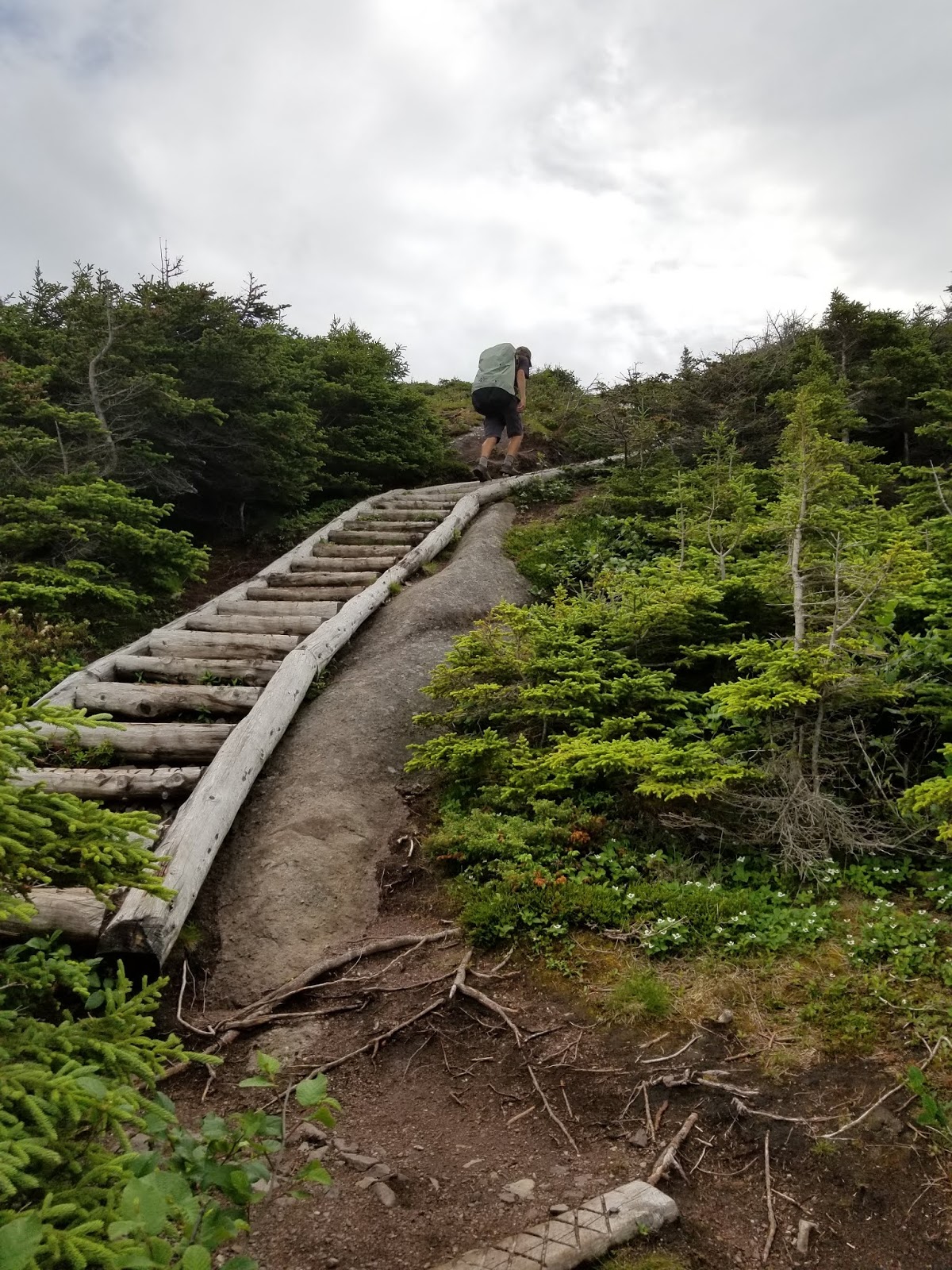
else do you need? It did have an awful lot of wooden stairs, both
going down (which was enjoyable) and going up (which was tough).
Even though the stairs were steep and long, having scrambled up and
down so many steep slopes on the rest of the trail, I was very happy
they existed!
The trail began as a series of well-maintained boardwalks over swamp and mud, and then took us through a
forested area, before coming out to Torbay Point, with a beautiful
view up the coast.


After this, we had periodic views of Red Cliff and several small fishing boats below. The most challenging part was a steep descent to Cobbler's Brook, which was promptly followed by an equally steep ascent up to Redcliff Head. Along the way, we were rewarded with relatively easy-to-navigate trails, and wonderful views down the coast.


Towards the end of our hike, we came to another World War II pill box, alongside several derelict buildings which had been profusely spray painted.


After moving along the coastline the trail again entered a stand of dense tuckamores, which were welcome, as the rain had begun again. As we approached the end of the trail we passed two young ladies who were amid their thru-hike, and who looked very vigorous and full of energy. They mentioned that we should be sure to stop and watch two whales up ahead, although we never did encounter them.


We came to the point in the trail where you have the option to proceed straight along to a viewpoint or exit the trail onto Red Cliff Rd. To get to the road you have to pass the abandoned radar station, walk under a communications tower, and continue down the hill beyond that. At first, we had difficulty locating the footpath through the bushes, but once we found it, it became easier to follow. However, it was very overgrown, and it soon became very steep – more of a washout, consisting of loose dirt and pebbles on hard-packed soil and rock than a trail. Following this unmarked route down the hill, we emerged between two houses onto the road and found the trailhead for the Cobble Path. I think we would never have found our way out of there if we hadn't watched Randy Best's instructional video on the route – so thank you once again to Mr Best!
It was hard for us to assess today's
hike. The terrain and infrastructure seemed much easier to navigate
than some of the trails farther south, but we weren't carrying our
fully loaded packs today, so maybe that made the going easier too.
Either way, this section of the trail had a different feel to it –
like we were in a much more developed area, which of course we were.
Excited by our progress today and grateful to be able to return to the ECT, we
grabbed a taxi back to Memorial University to find some dinner. Tomorrow we plan to
walk the Sugarloaf Trail from Logy Bay to Quidi Vidi village so the adventure along the Avalon Coast is not done yet!
See you on the Trail!
______________________________________________________________________________
Practical Information:Paths: Father Troy's Trail, Silver Mine Head Path, Cobbler Path
Distance Hiked: Trail = 16.5 km, Connector = 5.0 km, Total = 21.5 km
Comments
Post a Comment