East Coast Trail Deadman's Bay Path : St. John's to Blackhead
East Coast Trail Deadman's Bay Path
ECT Thru-Hike
We were awake early, well-rested and
excited to make our second attempt at the East Coast Trail. By 7:30 AM we were
packed and downstairs enjoying a continental breakfast at MUN, which
consisted of coffee, muffins, and chocolate croissants. The young
lady at the reception desk greeted us cheerfully, wished us the best
of luck, and again did us the favour of calling a taxi to the
University. By pleasant happenstance, the same driver who took us to
Portugal Cove picked us up again. He happily took us up to Fort
Amherst, the northern trailhead to Deadmans Bay Path. En route he
reminisced about his time as a regional Scout leader, and all the
hikes and camping trips he took beavers, cubs, and scouts on. He
also described his volunteer work which involved fundraising for
disabled and abused children by helping to set up local quad, or 4x4
vehicle, drives around the province. All in all, he reminded us that
true change is often quietly built by those passionate individuals in
each community who tirelessly work to help others.
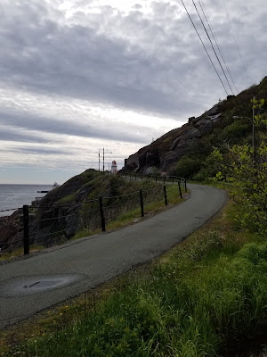
Too soon we reached Ft. Amherst and its
lighthouse. The approach road was so narrow we worried that our taxi
driver would not be able to get back out, but he assured us that he
had done so before. He also offered us a piece of advice “to watch
the winds and stay safe” - sage commentary. He too wished us luck,
and we trekked the remaining few meters to the base of the hillside
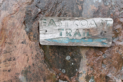
where we found the sign for Deadmans Bay Path as well as a metal sign for the Great Trail / Trans Canada Trail.
We again began our trek with a set of stairs. Although they were steep, and there were quite a few of them, they were very well constructed and easy to climb, making us grateful once again for all the hard work put in by the volunteers to establish this section of trail.
Within our first half hour of hiking, we met another thru-hiker heading south by the name of Trace. This intrepid young man had also started further north and been caught in the recent storm, and like us, he had spent a night in St. John's drying our before persevering and continuing on. His goal for today was to cover approximately 21km, with the hope of finishing the entire ECT in 10 days. By comparison, our goal was to at least get to Freshwater Bay (5.2 km away) with the hope of pushing on to Blackhead (10.6-11.6 km away). Given the pace Trace was setting he soon disappeared over the coastline on his own adventure.
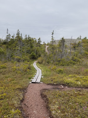
As we continued along the ridge line of the South Side Hills, following the white and black posts set into the rock, we quickly fell in love with the clear panoramic views of the Atlantic Ocean, Signal Hill and Ft. Amherst, as well as the beautiful landscape.
As we passed by Soldiers Pond and Sandy
Bottom we first started to notice and appreciate the artistic and
painted signs which are unique to each location along the
trail. When we reached the descent along Ennis River we found that
it required our full attention, largely because the recent rainfall
had transformed the pathway into a stream. It was a challenging
descent, especially with legs still lodging a protest against their
unexpected mistreatment two days ago, but also beautiful and quite
fun.
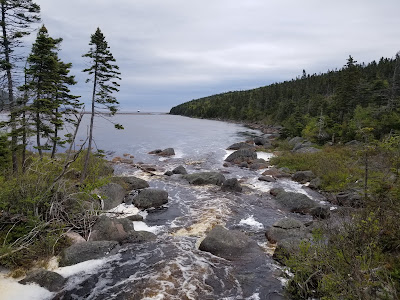
When we reached Freshwater Pond, which is a pond at the end of a cove that is separated from the ocean by a thin band of rocks, we were very impressed with it. We spent some time sitting in a nice camping spot and watching the waves crash against the rocks. During our break, we also watched a Common Tern fishing in the ocean and noticed a very cute, Spotted Sandpiper foraging among the rocks.
Having noticed that there was a 15-20
ft breach in the rock walkway that crossed the bay, we opted to take the 1 km alternative
route via Leamys Brook to save ourselves from getting wet feet. The trail
climbed upwards through a dense forest, which provided a respite from
the rising winds, and some coverage from the ever-warming sun. On
the detour, we saw one of the fanciest hiking bridges we've ever come
across!
Once we had climbed back up out of Freshwater Pond and were back on the ridge line, we were treated to stunning views back along the coast.
A little farther along we saw several gull colonies around Small Point, Windy Cove, and Peggy's Leg. It was incredible to see so many nests perched on those tiny ledges, out in the ocean. How don't they blow away? We took the time to photograph and try to identify some of the birds we hadn't seen before. Among the species we recognized were Great Black-backed Gulls, Herring Gulls, and possibly an Iceland Gull. It was very exciting!
After this gorgeous section, the
pathway soon opened up and descended into the village
of Blackhead, bringing us to the conclusion of Deadmans Bay Path.
Since it was late afternoon, and we would have to pass Cape Spear and
then walk quite some distance to the next possible camping spot, we
decided to stop in Blackhead Village for the night.
After doing some scouting we chose a campsite just off the trail on the north side of the village, tucked behind some trees, and near a bench and fire pit. This campsite provided us with coverage from the wind, a view of the ocean, and a source of water nearby – in other words, a great spot! As an aside, in windy conditions the trailhead south of the village would be another possible spot to camp that would be more sheltered from the wind.
After doing some scouting we chose a campsite just off the trail on the north side of the village, tucked behind some trees, and near a bench and fire pit. This campsite provided us with coverage from the wind, a view of the ocean, and a source of water nearby – in other words, a great spot! As an aside, in windy conditions the trailhead south of the village would be another possible spot to camp that would be more sheltered from the wind.
Once we had the tent set up I boiled
the last of our water and made reconstituted Peppered Macaroni and
Cheese, which we ate on the cliffside as a fishing boat set out its
lines for the night. After dinner we cleaned and dried our clothes, purified some water from the nearby stream, and then relaxed,
enjoying a beautiful night with a full moon.
Today was wonderful. We learned that
the distances we can travel with packs are far less than we can cover
without them. We also learned that our bodies still hurt from the
rope descents on the Piccos Ridge Trail a day ago. Finally, and best
of all, we were reminded that a rugged landscape gives way to rugged
yet beautiful views.
Tomorrow our goal is to complete the
short Blackhead Path, visit Cape Spear, and trek along the Cape
Spear Path to Deep Cove and stop at the established campsites in that
location.
See you on the Trail!
_______________________________________________________________________________
Practical Information:
Practical Information:
Paths: Deadmans Bay Path
Distance Hiked: Trail =10.6 km
Max Temp: 18.1 °C
Min Temp: 3.1 °C


Comments
Post a Comment