Whales and Warm Welcomes on the ECT : Chance Bay to Bear Cove
Whales and Warm Welcomes on the ECT
East Coast Trail Thru-Hike
We awoke early this morning on the East Coast Trail to the soft
patter of rain on our tent, which didn't provide much incentive to
leave our sleeping bags. Instead, we enjoyed the shifting light of
the morning through our screen door until the shower had passed, and
then begrudgingly got up around 7 AM to make breakfast. Just as we
were finished packing, we were intrigued to hear a loud huffing sound
in the cove.


We quickly ran over to investigate, and discovered that a humpback whale was fishing right there in the cove!! We watched for quite a while as it circled around, breaching, spouting, and slapping its tail a couple times. There were more whales just outside the cove as well, visible by their spouts. It was very difficult to leave this exciting cove behind and continue on down the trail.

Spurwink Path
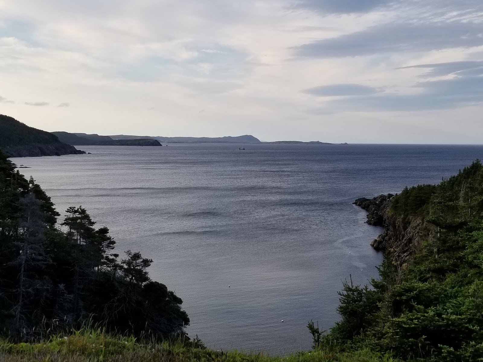
This morning the Spurwink Path took us
over soft hills, along beautiful coastlines, and across exposed heath
meadows. Many of the more open areas provided clear, panoramic views back down the coast to Ferryland and the lighthouse at the Colony of Avalon.


From atop Bald Head, we saw two whales very close to shore, far below us, and we again stopped to watch. Our progress today was slow with all the distractions, but we thoroughly enjoyed it.


From atop Bald Head, we saw two whales very close to shore, far below us, and we again stopped to watch. Our progress today was slow with all the distractions, but we thoroughly enjoyed it.


Port Kirwan Newfoundland
Eventually, we came to a well-maintained
gravel cart track, which soon brought us to the tiny and charming
town of Port Kirwan. Just as we entered Port Kirwan we passed a nice-looking campground, which would have made a nice spot to stop for the
night, but we decided to push on. After we climbed and descended a
rather large hill we started down the paved connector road through
Fermeuse.


Here our experiences were somewhat
mixed. The trek into Fermeuse involved several steep climbs, which
were rather hard on the pavement. However, we also passed a beautiful
church, rescued a baby starling from the roadway, marvelled at a row
of wind turbines on a nearby ridge, and easily found Highway 10.
Also, we were passed by many friendly motorists who offered us lifts.
Although we didn't accept any of their generous offers, we were
heartened by this overwhelming show of kindness from random
strangers.


Along the connector, we came to another nice resting spot with a picnic table, an information plaque, and a great view of the area, and we stopped to take a short break.


Along the connector, we came to another nice resting spot with a picnic table, an information plaque, and a great view of the area, and we stopped to take a short break.

When we reached Fermeuse, nearly an hour after leaving the trailhead, we were hoping to stop for a cold drink and a bite to eat at one of two local restaurants. To our dismay, we discovered that one of them “had been closed for years,” even though online it appeared to still offer daily specials, and we were unable to find the other one, despite locals advising us that we could see it from the intersection we were standing in. Google Maps also suggested we should be able to see it, but there was only a private residence on the spot. So, we purchased two ice creams from the convenience store and continued down to the government dock to take a break and enjoy them.

After our short break, we continued
around the harbour on the road, but we soon became uncertain of where
to go, and the instructions on the ECT map were not helpful. We
found a gravel track that took us down into a field of junked
vehicles and derelict buses. It then climbed
steeply uphill through a forested area. We were reluctant to start
the steep, rocky climb without being certain it was the right way,
but with no other options, we headed up. About halfway up the hill, we saw a small white triangle that marked the trail, indicating we
had guessed correctly.


Bear Cove Trail
From there we followed markers for a while until we emerged into a beautiful grassy field that was covered in
crisscrossing ATV trails and tracks. Unsure where to go, we decided
to head down to the coast, thinking we might see the remains of a
sunken ship the ECT map mentioned. We came to a lovely-looking
beach but had clearly lost the trail. Getting a bit tired of
wandering in circles, we headed back up to the field and decided to
ask for directions to the Bear Cove Trail at the cabin on the
opposite side of the field.


As we approached the grey cabin, we
were greeted by Reg and Kathy, the first trail angels we have
encountered on the ECT so far. They told us we were on the trail,
that it continued up behind the cabin, and that they kept putting up
a sign for hikers, but it kept getting taken down. They then invited
us inside for tea, coffee, or beer, and told us they make an effort
to have fresh water available for hikers passing through. Reg was a
larger-than-life character who regaled us with stories of helping
other hikers, and local Scout Troops, his life as a truck driver, his
family, his pets, his antics in tricking foreigners into thinking he
could call moose, and his life growing up in the area and the returning to build his cabin. He showed us photos of his family and the land from the 1950s when
there were no trees at all, which were very interesting to see, given
that the area is now forested. The change, which was apparently
brought about by natural regeneration alone, was remarkable. It was truly
amazing to find these kind, generous, warmhearted people who had
found happiness in a simple cabin with a wonderful view. Eventually, we
left, with two cup-a-soups in hand, grateful for and humbled by their
hospitality.
Following Reg and Kathy's directions we
continued up the trail into the forest, past an old burnt cabin and
the remains of an abandoned community, always keeping to the left.
In the next stretch of trail, we were surprised and delighted to find
well-maintained boardwalks, plentiful stairs in excellent condition,
and a minimum of mud! It seemed trail maintenance had recently been
done, and we were very thankful to the wonderful volunteers who did
it!


As we neared Bear Cove Lighthouse, we
spotted several other tents pitched along the trail. Shortly
afterwards we found a sheltered spot near the Lighthouse on which to
pitch our tent and set up for the night. We walked down to the
Lighthouse, which seems to be under construction, and took a look at
the Lighthouse keeper's residence. It doesn't seem to be occupied
anymore and needs repairs, but it has a quiet beauty to it.
Down in the cove below we watched a flock of gulls playing in the
wind, a seal fishing, and the waves crashing into the shore.

We prepared a dinner of pasta and cheese, followed by the usual cup of tea. In this section, the water is brown, which is not too appetizing, but thankfully it smells and tastes fresh enough.

 | |||
| Clean water from the stream |
As we returned to our tent we realized
that tonight may well be our last on the ECT section of the Trans Canada Trail. We plan to hike to
Cappahayden tomorrow, and given the warnings of heavy rain and high
winds brought by Tropical Storm Chris tomorrow night, we may decide
the take a taxi back to St. John's tomorrow afternoon, rather than
wait for the cheaper shuttle the following morning.
See you on the Trail!
_______________________________________________________________________________Practical Information:
Paths: Mudder Wet Path, Bear Cove Point Path
Distance Hiked: Trail = 10.3 km, Connector = 7.3 km, Total = 17.6 km
Max Temp: 23.0 °C
Min Temp: 12.5 °C
Comments
Post a Comment